Adventists Study the Geology of Nevada and Utah–Part 2
By Robert T. Johnston, July 1, 2016: When John McLarty invited me to join a small group of Adventists for a week-long geology field trip in Nevada and Utah, I needed no arm-twisting. The cost was reasonable, partly because we camped and prepared our own meals; the only question was whether I could clear my calendar.
Sunday, May 8, 2016, I found myself in the baggage claim area of Las Vegas’ McCarran International Airport texting strangers as we sought to find each other. We had converged on Sin City to examine first-hand some of the regional geology. Some of us were retired, while others were active employees of public or denominational entities. Except for McLarty, for whom geology has been a lifelong interest, most of us had little geological experience but were eager to learn. We looked forward to a week of desert camping, hiking, geology education, fossil hunting, discussions about chronology and theology, and fellowship.
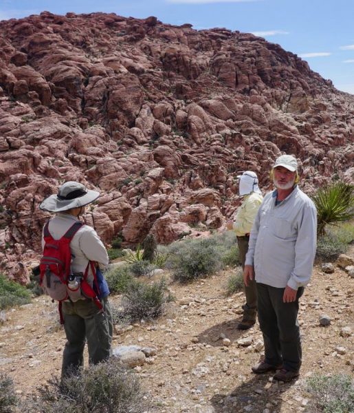
In the McCarran parking garage we met McLarty and Dr. Gerald Bryant, a geology professor at Dixie State University in St. George, Utah. As a sedimentologist and an expert on the Navajo Sandstone, he was the perfect guide to the geology of the area. We loaded our gear into the back of his 4×4 pickup and McLarty’s SUV and headed for Red Rock Canyon to meet the rest of our group, who had driven down from the Walla Walla area.
We stopped at the first outcrop of the Navajo Sandstone (known locally as the Aztec SS) in the park. It is approximately 190 million years old (ca 190 ma). (I will include the dates assigned by conventional geology. Young earth creationists disagree with the dates but agree that these dates accurately express the relative depositional positions of the formations; that is, older formations were created before younger formations.) Bryant asked us what we saw. His teaching style was to encourage us to “have a conversation with the rocks,” engaging our minds and senses as we studied ancient rocks or modern dunes and streambeds. As we began to notice and point out various features, Bryant explained their significance with respect to both geology and chronology. The evidence that these crossbedded structures were formed from wind-driven (eolian) dunes is compelling; underwater (sub-aqueous) sand structures have different dimensional ratios than eolian dunes. Also, larger particles don’t get carried by wind whereas they are incorporated into sub-aqueous sand structures.
H.E. Gregory’s initial description of the rock unit he named the “Navajo Sandstone” (for its extensive exposure across the Navajo Nation of Utah and Arizona) appealed to processes of deposition associated with desert dunes. This ran contrary to conventional wisdom at the turn of the 20th century, which held that all extensive deposits of uniform lithology must have been deposited in a marine environment. Gregory’s interpretation went uncontested, primarily because no bedforms of adequate size to produce the large-scale crossbedding characteristic of the Navajo had been observed in other environments. However, this barrier was broken when the side-scan sonar technology developed during WW II was applied to exploration of North America’s continental shelves. For the first time, it became apparent that powerful currents could sweep the ocean floor in deep water, redistributing the sand and forming large dunes. This discovery prompted various attempts to re-interpret the Navajo as a marine deposit, calling into question every criterion that had been advanced in support of an eolian depositional environment. The research programs engendered by this debate established eolian sedimentology as a vibrant sub-discipline, encompassing experimental approaches in large wind-tunnels, the exploration of modern Earth environments, the investigation of ancient deposits, and the interpretation of remote-sensing data from throughout the solar system. The marine hypothesis was ultimately rejected as a result of these studies. The topic has not been under active debate in the professional community since well before the start of the 21st century; however, creationist “flood geologists” continue to champion the undersea interpretation, rejecting the findings of the professional community during the 1970’s and 80’s. They argued—and continue to argue—that these imposing sedimentary structures resulted from Noah’s flood. (See, for example: Hoesch, W. 2008. Marketing the Navajo Sandstone. Acts & Facts. 37 (6): 14).
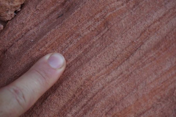
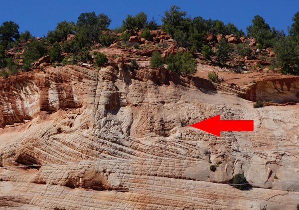
Crossbeds are formed as wind-blown sand is swept up the windward side of an advancing dune and is deposited on the lee slope, or as sand build-up on the dune crest exceeds the angle of repose and a mini-avalanche occurs. These thin deposited layers (foresets) are tilted at approximately 28° from the paleo horizontal (compaction flattening reduced the angle from the 32° angle of repose for dry sand), and are clearly visible because of particle segregation by size and density that occurs in each layer in the deposition process. The visibility of these layers is enhanced by diagenetic iron coloration (that is coloration that occurred long after the dunes were emplaced). Small surface ripples in the leeward slope can also contribute to foresets.
With an estimated annual dune migration of about 1 m (based on correlations between weather cycles and sedimentation patterns), and the Navajo dunes covering an area of at least 265,000 km2, one begins to get a sense of the time scale for a single dune to migrate across the area, not including the time for formation of the sand in the first place by weathering of the Appalachians, followed by aqueous transport to the immediate source area north of the Navajo. After the wind had spread the sand southward, more time was required to bury the deposit beneath thousands of feet of additional sedimentary layers and cement the sand grains into rock (lithification), before the modern regime of uplift and erosion was able to form the canyons we see today. And, there are multiple layers of crossbeds, each representing another dune migrating through; the Navajo Sandstone is up to 700 m thick!
The geologic story is further complicated in Red Rock Canyon. There, the Navajo Sandstone is capped with thousands of feet of Paleozoic carbonates, generally formed from marine life, which were formed before the Navajo Sandstone but thrust over it by tectonic activity (the Keystone Thrust Fault, about 65 ma). The sandstone was already lithified by the time this overthrust occurred.
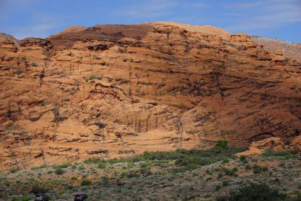
One prominent feature in the sandstone visible at our first stop in Red Rock Canyon was a chaotic structure where the regular sediment layers were grossly disturbed or even erased. This evidence of a “liquefaction event” was something we would see repeatedly on the trip. Analogous to what happened in San Francisco’s Marina District during the 1989 Loma Prieta earthquake, oscillation of moist sand during an earthquake led to liquefaction, often with a fault visible nearby. Dune deposits later laid down over the remains of the liquefaction event were normal crossbedded structures, due to wind-blown sand. These structures are difficult to explain by a short chronology sub-aqueous process (such as Noah’s flood). Instead, they tell a story requiring long periods of time for the development of the accumulating layers of dunes.
We camped at Valley of Fire State Park, where we saw more crossbedded Navajo Sandstone, surrounded by towering peaks of carbonate rock. At the bottom of the canyon, deep erosion revealed the Shinarump Conglomerate (ca 230 ma) containing carbonate rocks and fossils, including petrified logs. At Atlatl Rock we viewed ancient (ca 4000 BP) Indian petroglyphs chiseled into an exposed cliff face. Above these were positive impressions remaining from small reptile tracks embedded in the Navajo Sandstone. It is difficult to interpret the massive sandstone structures—built by sedimentation of eroded Appalachian rock, embedded with reptile prints but not fossils of grasses and other post-Jurassic plants, discolored by iron migration and lithified by migration of cementitious minerals, partially eroded to create valleys amidst towering red cliffs, then carved by ancient man—by a short chronology.
Valley of Fire also provided our first of several looks at interdune deposits. The low-lying areas between dunes sometimes contained moisture or even pools of water, making them favored habitat for various forms of life. The moisture caused dust to be trapped there, so that the flat-lying interdune deposits have a different texture than the layers (foresets) of sand deposited on the leeward side of dunes to make crossbedded structures. At some locations, interdune deposits include non-sandstone rock types, limestones and dolostones formed by chemical processes in the highly evaporative, ancient ponds. Multiple Interdunes may sometimes be observed in cliff faces, one above another separated by crossbeds. This genetic association of rocks formed from transported particles with others constructed from ions transported in solution is difficult to reconcile with a short chronology and a single “Flood.” This difficulty is magnified by the presence of burrows, tracks, and other evidence of life within the interdune environment. In some locations, multiple such interdunes are found vertically stacked tens or hundreds of meters apart in the same cliff face, with several crossbeds in between, further challenging a flood geology interpretation.
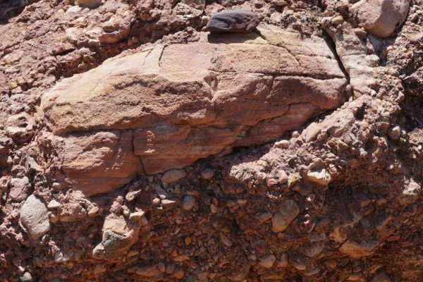
After hiking through a canyon of sculpted sandstone, we found a layer of conglomerate (from the base of the lower member of the Willow Tank Formation, ca 100 ma) that contained a chunk of the Navajo Sandstone. This is difficult to explain without the sand being lithified by the time of the flood event(s) that produced the conglomerate and incorporated the sandstone therein. Some flood geologists argue that the sandstone sediments were created during Noah’s flood and not lithified until afterwards. I wondered, How could wet sand fracture in a brittle fashion to produce a block, and how could that wet, nonlithified block of sand hold its shape and layered structure through the force of a flood powerful enough to form conglomerate?
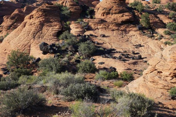
We camped two nights at Snow Canyon State Park near St. George, UT. There we found a series of lava flows on top of deeply eroded sandstone, with multiple volcanic vents visible above the canyon. Volcanic eruptions occurred at different stages during the incision of the landscape, producing topographic inversions, so that streambeds capped by lava flows now form the high ground of buttes and mesas. (That is, earlier lava flows followed a path to lower elevations like water does. When the lava solidified, it formed a protective cap over these streambeds, so that subsequent aqueous erosion produced new streambeds in what was once higher sandstone, and eventually the older lava was left as a cap protecting outcrops—what was once the lowest, now the highest. Newer lava flows followed the new, and lower, streambeds). Radiometric dating (the “clock” is reset in molten lava, allowing the lava solidification to be dated) reveals a few-million-year history of episodic volcanism, amid ongoing erosion of the sandstone. The poor state of preservation of the older flows, relative to the younger, corroborates the relative chronology of the volcanic events. This complex arrangement of features on top of eroded Jurassic Navajo Sandstone is difficult to explain by a short chronology that dates the sandstone to Noah’s flood.
In the St. George area, we visited several sites including an ancient streambed where the complex array of sedimentary structures has been preserved in a plan-view exposure (in contrast to the cross-sectional views we typically observed) very much like that of the modern washes we hiked in. The coarse deposits of the streambed were covered by thick layers of fine silt marking an abrupt and dramatic change in energy in the depositional environment (silt settles only from relatively quiet water). We visited a similar, plan-view exposure of a different layer in an extraordinary museum (Johnson Farm) built over the excavation of a dinosaur trackway. At this site, the interplay of various forms of life with ongoing sedimentation processes was recorded in even finer detail.
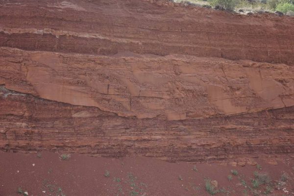
A volcanic ash layer was clearly visible in a roadcut through the slopes behind St. George. This is problematic for its residents because the ash has aged to become clay, which is slippery when wet, with the result that when developers cut into the base of the hillside, the mountain above began sliding down into the town! The ash layer is also problematic for flood geologists, for it is difficult to understand how volcanic ash could be distributed in a distinct band of a few inches thickness if the entire sediment column was formed under water during Noah’s flood.

In the same roadcut the cross-section of a filled-in flood channel in the Kayenta Formation is preserved. The channel cut through the volcanic ash layer shown in Figure 7. The channel is filled with sand, surrounded by darker silt layers that Bryant attributed to deposition on a floodplain. The uniformity and regularity of the channel deposits argue in favor of deposition during a single flooding event, which scoured out the channel at highest energy flow, deposited the sand as energy waned, and deposited the silt in a final, low-energy phase. Bryant interpreted everything from the bottom of the channel to a little ledge within the siltstone to be the product of a single event, which came after the flood plain was subaerially exposed and received the ashfall. If all these deposition layers were formed by Noah’s flood, it is difficult to explain the stream cutting through the ash layer, filled in by sand particles in layers contoured to the streambed, and capped by horizontal sediment.
Evidence for catastrophic events, including earthquakes, floods and volcanic eruptions, are found throughout the region. We viewed the Hurricane Fault and the Virgin Anticline, evidence of tectonic activity and erosion on a massive scale. Despite the frequent charge by short chronologists that conventional geologists are slaves to Lyell’s “uniformitarianism”, “catastrophism” is widely accepted by modern geologists. However, the geological evidence is best explained by multiple catastrophes over eons, not a single global flood event.
On our hikes, and especially over dinner and around evening campfires, conversation frequently turned to the theological and ecclesiastical implications of what we were seeing. It is easy to point out the theological challenges posed by evolution and long chronologies, as fundamentalists are wont to do. It is also easy to point out scientific impossibilities in young earth creationism. It is difficult—and within Adventism, lonely—to seek answers that hold together theology and science. Bryant made the point that science is a community endeavor, and ultimately the facts rule. If one lets religion trump facts, that isn’t science. On the other hand, church is also a community endeavor, and when a majority insists on having its way, overriding people of conscience who disagree, damage is done to the community. Post-San Antonio, it is increasingly difficult to be a church-employed scientist, educator, pastor or theologian if one does not accept a “recent” creation in six literal days, even though the scientific evidence against “recent” is overwhelming and increasing.

From St. George we drove to the Kanab, UT area where we stayed at Coral Pink Sand Dunes State Park. Its extensive field of modern sand dunes derived from erosion of the Navajo Sandstone provided an opportunity to see how the wind shapes dunes to create crossbedded structures as well as secondary surface ripples, both of which are preserved in the Navajo Sandstone.
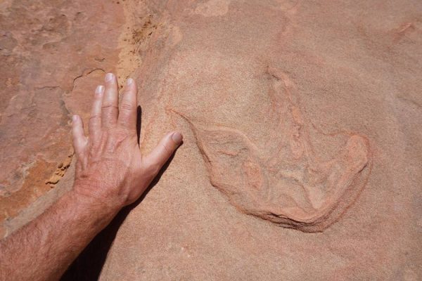
One of the highlights of the week was a 4-wheel drive trip to the Moccasin Mountain Tracksite. There we studied sandstone layers where there were extensive dinosaur tracks, sometimes one on top of another. Dinosaur claw imprints were also visible. The most heavily traveled layers appeared to be reactivation surfaces (layers that often represent a change in climate or other control factors that may cause a shift in the direction of dune growth). Surrounding layers seemed to be devoid of tracks. Bryant explained that these surfaces had the right moisture to preserve the tracks, and in any case, animals generally preferred to walk through the lowlands or near water, rather than climb over a dune. Prints went in both directions along the busiest tracks. It is difficult to interpret these tracks as those of dinosaurs crawling to the top of dunes to escape Noah’s flood; more likely, they were looking for a drink or a meal.
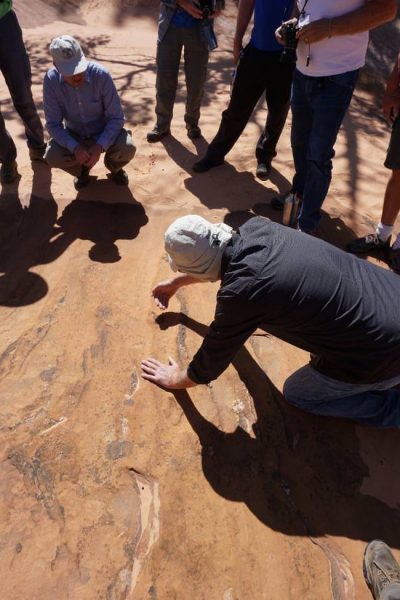
Near Kanab we viewed a research site studied by one of Bryant’s students. A sandstone outcrop exhibited a fluidization event as well as several faults and related fractures. Crossbedded structures above the faults place the earthquake within a time interval. It is difficult to conceive of a short-chronology, underwater process that would produce a fault and related fractures, then cover them with crossbeds. (A rattlesnake on the hike back to the cars reminded us to carefully watch all elements of our environment!). We drove a little further and stopped along the roadside to view yet another fluidization event preserved in sandstone, clearly contrasting with the weathered crossbeds around it.
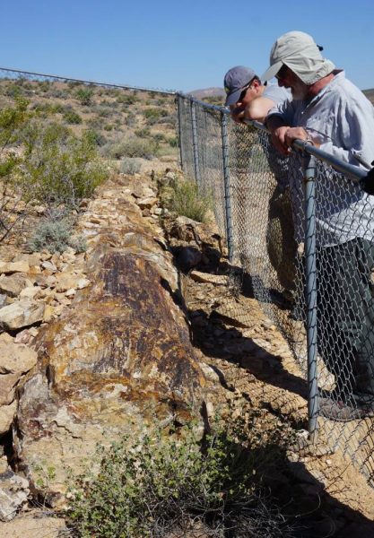
Also near Kanab, Bryant showed us an outcrop of Shinarump Conglomerate (ca 230 ma) within which we could view a petrified logjam. This tangle of logs and rounded rocks was similar to logjams found in modern streams after floods or heavy torrents. This logjam was protruding from the edge of a cliff overlooking a large eroded valley. It occurred to me that it must have taken a long time to erode the valley. On the other hand, if it were eroded within a few days or weeks during Noah’s flood, then the exposed logjam should have decayed instead of been petrified.
We hiked through a portion of a beautiful slot canyon, Buckskin Gulch, where we saw towering Navajo Sandstone cliff walls eroded by water. Near their bases were weathered petroglyphs (bighorn sheep appeared to be a popular subject). In the narrow slot canyon we found a modern logjam, except that this one was suspended over our heads, caught between the narrow canyon walls during a flash flood. It seems clear that the tall canyon walls must have been lithified by the time they were formed or they would have collapsed. This argues against a flood geology interpretation of the sediment formation and erosion processes. On the other hand, if the canyon was formed by conventional river and flash flood action, it must have taken eons to erode. Consistent with that interpretation, the low-lying petroglyphs suggest that there has been little change in canyon depth in the past couple thousand years.


After our final sandwich lunch near Buckskin Gulch, we loaded the coolers back in Bryant’s dusty pickup and headed for Zion National Park. Entering at the east entrance, we passed the famous Checkerboard Mesa with a new appreciation for the significance of its crossbedded structures. Stopping just before the tunnel, we hiked the Canyon Overlook Trail for a terrific view of Zion Canyon. The trail looked down on a slot canyon. Above the slot canyon towered at least 15 crossbeds stacked one above another. The scale of crossbedding in Zion was impressive, and the combination of crossbedded structures and deep slot canyon is difficult to explain by short chronology flood geology.
For a portion of the trail, we walked on an exposed interdune surface, about 6-8 inches thick. The interdune layer then turned up sharply, distorted by a tectonic event. Nearby was a dramatic fluidization feature, and z-shaped patterns in the foresets formed during collapse of a dune front across an interdune expanse. A truck-sized rock formation Bryant calls the “Rosetta Stone” provides distinct evidence of interactions between surface and sub-surface processes, helping geologists to bracket the event history of what we had seen and walked over. That one rock contained a fluidization feature, fault lines, a displaced and twisted interdune layer, and the deposits of a large dune that climbed over this wreckage.

Zion is famous for the arches in its canyon walls, formed by weathering. Water percolates through porous sandstone, but when it reaches a hard impermeable layer, sometimes an interdune deposit, it travels horizontally instead of downward. When it reaches a canyon wall, it “weeps”, creating a wet zone where one sees a line of moisture-loving green plants thriving in the desert environment. As water continues to flow over long time periods, it leaches minerals that cemented the sand into stone. Eventually the sandstone crumbles and a section of canyon wall collapses. Other weathering processes also contribute to the erosion, including thermal expansion and freeze/thaw cycles. An arch is left behind. In addition to the time required to transport the sand, form crossbeds, lithify, then erode the canyon, we are left to contemplate the time required to dissolve cement with seeping water, in some cases enough to create overhangs wide enough to cover several cars.

On Sabbath, we enjoyed a “day off” from geology, though only from the formal education. Geology continued to surround us in the form of towering peaks, canyons, and the Virgin River bed. We bid Bryant goodbye; he had important duties to fulfill at the St. George SDA Church that day. The rest of our group broke up into smaller groups based on interests. Six of us rose early to hike to the top of Observation Point and look over the canyon from that lofty perspective. McLarty and another of our group managed to carry on deep theological conversations for the two hours it took to reach the top. I contented myself photographing the profusion of wildflowers and fabulous views. While McLarty napped at the top, several of us descended and explored Hidden Canyon. Later McLarty reported that he had found a profusion of marine fossils on the plateau behind Observation Point. Atop Zion’s 700 m Navajo Sandstone lies the Temple Cap Formation and atop that, the Carmel Formation (ca 170 ma). Carmel is limestone containing numerous marine fossils. Whereas at Red Rock Canyon tectonic activity thrust older carbonate rock atop the younger Navajo Sandstone, the Carmel limestone is younger than the Navajo Sandstone and was deposited in place. It is difficult to explain the presence of marine fossils in the Carmel but not in the Navajo if all this sediment was deposited by Noah’s flood.

A few of us capped our day by climbing to Angel’s Landing. The last mile of the hike is not for the faint-hearted. Sheer 1500 foot drop-offs on either side give fantastic views of the canyon but require that you hold onto a chain in several sections to avoid falling off. We met a local who told us that he had witnessed a woman plummet from the trail; her scream still haunts him. She had apparently let go of the chain to let another hiker pass, but then lost her balance.


Oddly, I was reminded of Ellen White’s vision of traveling along a narrow trail with a rock wall on one side and a precipice on the other. When the trail became too narrow, small cords were let down from the top of the wall which she and her fellow travelers grasped to keep their balance. Eventually the trail ended and they had to cling to the cords to cross a chasm and reach Paradise. They wondered if the cords would hold. White wrote (LS 190-93):
Again, in whispered anguish, the words were breathed, “What holds the cord?” For a moment we hesitated to venture. Then we exclaimed: “Our only hope is to trust wholly to the cord. It has been our dependence all the difficult way. It will not fail us now.” Still we were hesitating and distressed. The words were then spoken: “God holds the cord. We need not fear.” These words were repeated by those behind us, accompanied with: “He will not fail us now. He has brought us thus far in safety.”
White’s vision, of course, referred to the early Adventist experience after Christ didn’t return in 1844, causing many to doubt whether God had been leading their movement. White sought to reassure them that even though they had been rejected by their churches, who mocked them for the apparent failure of Miller’s (and Snow’s) prophetic scheme, God was indeed guiding them.
Although White strongly criticized “infidel geologists” who “claim that the world is very much older than the Bible record makes it” (3SG 91), I nevertheless find her vision a fitting metaphor for where I find myself as an Adventist today—though my path seems more like Angel’s Landing Trail, with a precipice on both sides! On the one side lies the precipice of atheism or agnosticism, denying any significance to God in my life in the face of natural evidence for which Adventism has provided me no adequate theological framework. On the other side lies the precipice of fundamentalism, denying the significance of Nature as interpreted by an overwhelming majority of scientists and instead insisting that a particular interpretation of the Bible is the highest authority.
I am 57 years old and still don’t have adequate answers. One week did not a geology expert make! Bryant repeatedly stressed the complexity of the history entrained in the rocks. While I tried to converse with the rocks as Bryant taught us, my rock language skills are still extremely limited. Neither has years of thought resolved the theological questions, despite hours of Bible study and prayer. In both science and theology, I have more questions than answers. What I am trying to do is cling to the cord of Truth, trusting that there is a loving God, and that He rewards those who seek truth wherever it may be found, no matter how difficult it may be to integrate that truth into our lives, religion and culture.
I am not trying to denigrate young earth or young life creationists, though I strongly disagree with their views and am angered by their (sometimes dishonest) efforts to purge the Church and its institutions of those holding to an old chronology for Earth and life upon it. I believe I am following the truth as best I understand it; they believe that, too. Our different life experiences, assumptions, personalities, etc., have led us to different positions. Many of us have, in fact, held opposing views ourselves at an earlier time in our lives. My personal belief is that we can better understand the Bible when we allow Nature to inform our interpretation of the Bible. Not everyone shares that belief.
The Seventh-day Adventist Church today seems to be offering a binary choice: atheism or fundamentalism. Leading voices say that if you don’t believe in a recent seven-day creation, you can’t be a Seventh-day Adventist. But there is a path between these extremes, as hard to find and narrow as it seems at times. Perhaps irrationally, I and many other Adventists are trying to stay on that path. The Adventist Church would better serve its members—especially the graduates of its colleges and universities—if it quit trying to push people off the path over one of the precipices, but instead constructed a chain for travelers to grasp, devoting resources to encouraging and strengthening those striving to maintain faith while holding conventional scientific views.
Perhaps the greatest joy of this field trip was the opportunity to spend a week with other Adventists who share this path. Those who are employed by the denomination face special challenges; I think they were even more blessed by this trip than I was. The experience of sharing our stories, questions and tentative answers was richly rewarding. I treasure the new friendships formed.
As we loaded the trucks Sunday morning for the drive back to Sin City and flights home, I asked my guide if I had to go, or if I could stay in Zion. He said, “You must return and write what you have seen and share it with others.” Stepping out of the airport in Houston, raindrops and oppressive humidity assured me I was home, and it wasn’t Paradise. But I hope to return soon—maybe even next year. (Contact John McLarty if you are interested in participating in a future geology field trip: johntmclarty@gmail.com).
Acknowledgements: The author wishes to thank John McLarty and Gerald Bryant not only for a terrific trip and learning experience, but also for reviewing this report and offering several helpful suggestions and clarifications. Any errors are my own.


